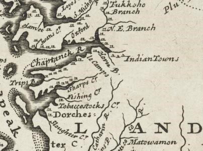
Choptank
Indians
Maps showing Choptank Indians
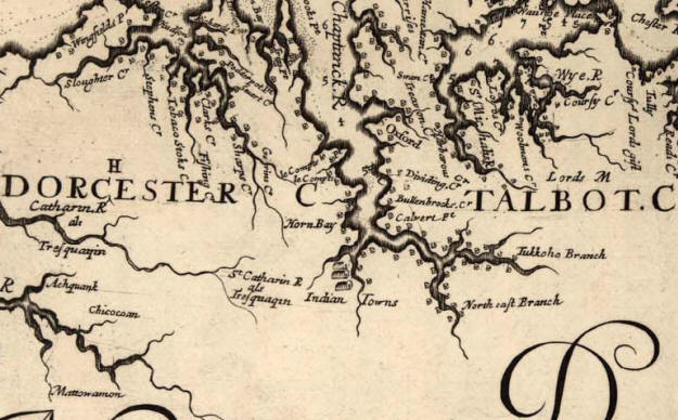
Virginia and Maryland as it is planted and inhabited in this present year 1670
Augustine Herrman
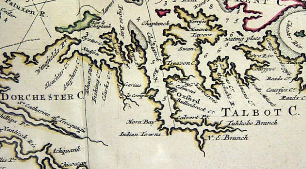
Carte Particuliare de Virginia Maryland Pennsilvanie la nouvelle Iarsey orient
et occidentale
1700 A.H. Jaillot
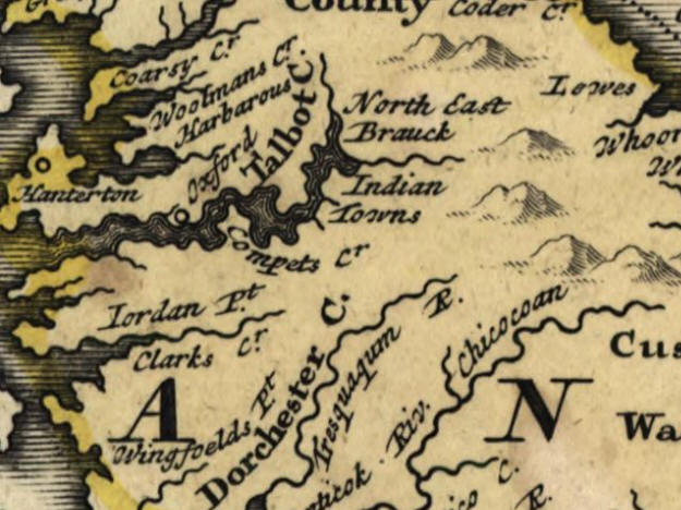
Virginia, Marylandia et Carolina 1714
Johann Baptist Homann
Virginia and Maryland 1732?
H. Moll, Geographer
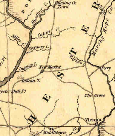
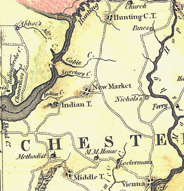
Map of the State of Maryland by Dennis Griffith.
Philadelphia June 20th, 1794.
Engraved by J. Thackara & J. Vallance.
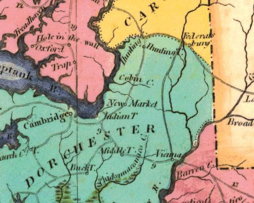
Map of Maryland 1822
by H.C. Carey & I. Lea
Geographical, Historical, And Statistical Map Of Maryland.
Maryland.,
Drawn by Fielding Lucas Jr.
Fielding Lucas Jr., Baltimore, Engraved by John West, Philadelphia,
December 1841