East New Market
Maps
1922 Interactive Map
Click on any property for photos and property history.
To retain clarity, this 1922 Sanborn Fire Map was left at its original large size. Therefore it is much larger than a typical webpage. Use the left and right scroll bar as well as the up and down scroll bar to see the entire map. It is worth the scrolling.
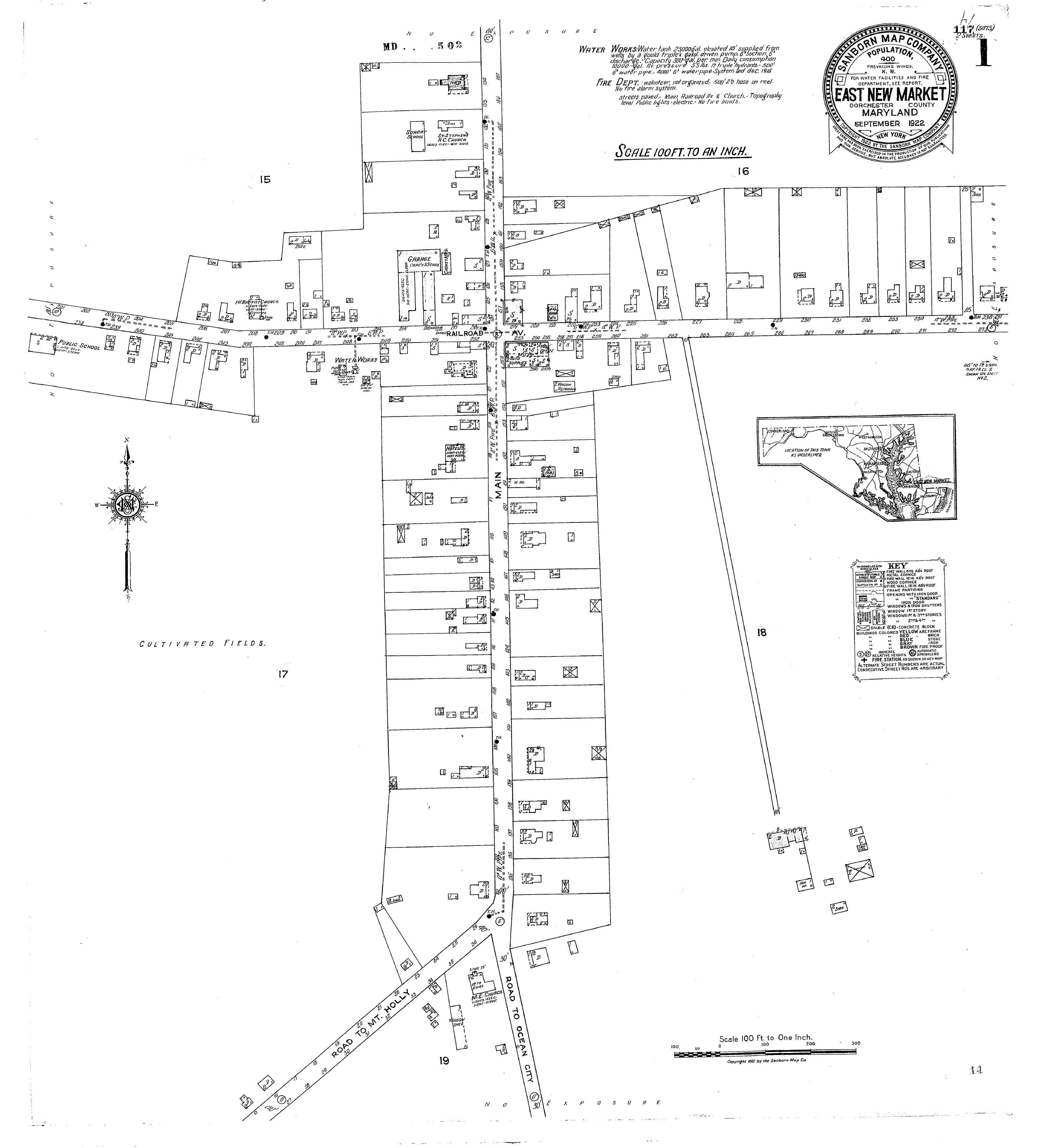
Edited from the 1922 Sanborn Fire Insurance Map for clarity- East New Market
Sanborn Fire Insurance Maps were designed to assist fire insurance agents in determining the degree of hazard associated with a particular property and therefore show the size, shape, and construction of dwellings, commercial buildings, and factories as well as fire walls, locations of windows and doors, sprinkler systems, and types of roofs. The maps also indicate widths and names of streets, property boundaries, building use, and house and block numbers. They show the locations of water mains, giving their dimensions, and of fire alarm boxes and hydrants.